This dataset include survey instrument and data used in a collaborative technology adoption study conducted by the Association for Strengthening Agricultural Research in Eastern and Central Africa (ASARECA) and IFPRI.
Search
Use quotation marks around a phrase or title for more accurate search results (example: “El Nino”). You may search by type, subtype, division, topic, and other facets by clicking the links in the left sidebar.
Your search found 8 results.
GIS dataset for constructing three-dimensional Development Domain for ASARECA's operation area in 12 East and Central Africa countries.
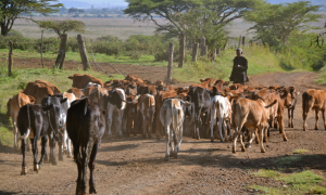
Resilience of food security in the arid and semi-arid lowlands (ASAL) in Kenya.
Reliable market accessibility data is critical to develop agricultural policies and investment plans for ensuring smallholder farmers’ market participation and their profitable farming, yet this data is less frequently updated.
Spatially-explicit data is increasingly becoming available across disciplines, yet they are often limited to a specific domain.
Yield gap of nine priority commodities of the African Development Bank was assessed and aggregated at two levels across the Africa continent:
Agro-Ecological Zones (AEZ) for Africa South of the Sahara (SSA) were developed based on the methodology developed by FAO and IIASA.
dataset
Urban extent of Africa 2010
Accurate delineation of the urban and rural areas has a broad range of implications on the quality and reliability of agricultural production and socio-economic statistics, design of household survey, establishment of agricultural development stra