Who we are
With research staff from more than 70 countries, and offices across the globe, IFPRI provides research-based policy solutions to sustainably reduce poverty and end hunger and malnutrition in developing countries.

What we do
Since 1975, IFPRI’s research has been informing policies and development programs to improve food security, nutrition, and livelihoods around the world.
Where we work
IFPRI currently has more than 480 employees working in over 70 countries with a wide range of local, national, and international partners.

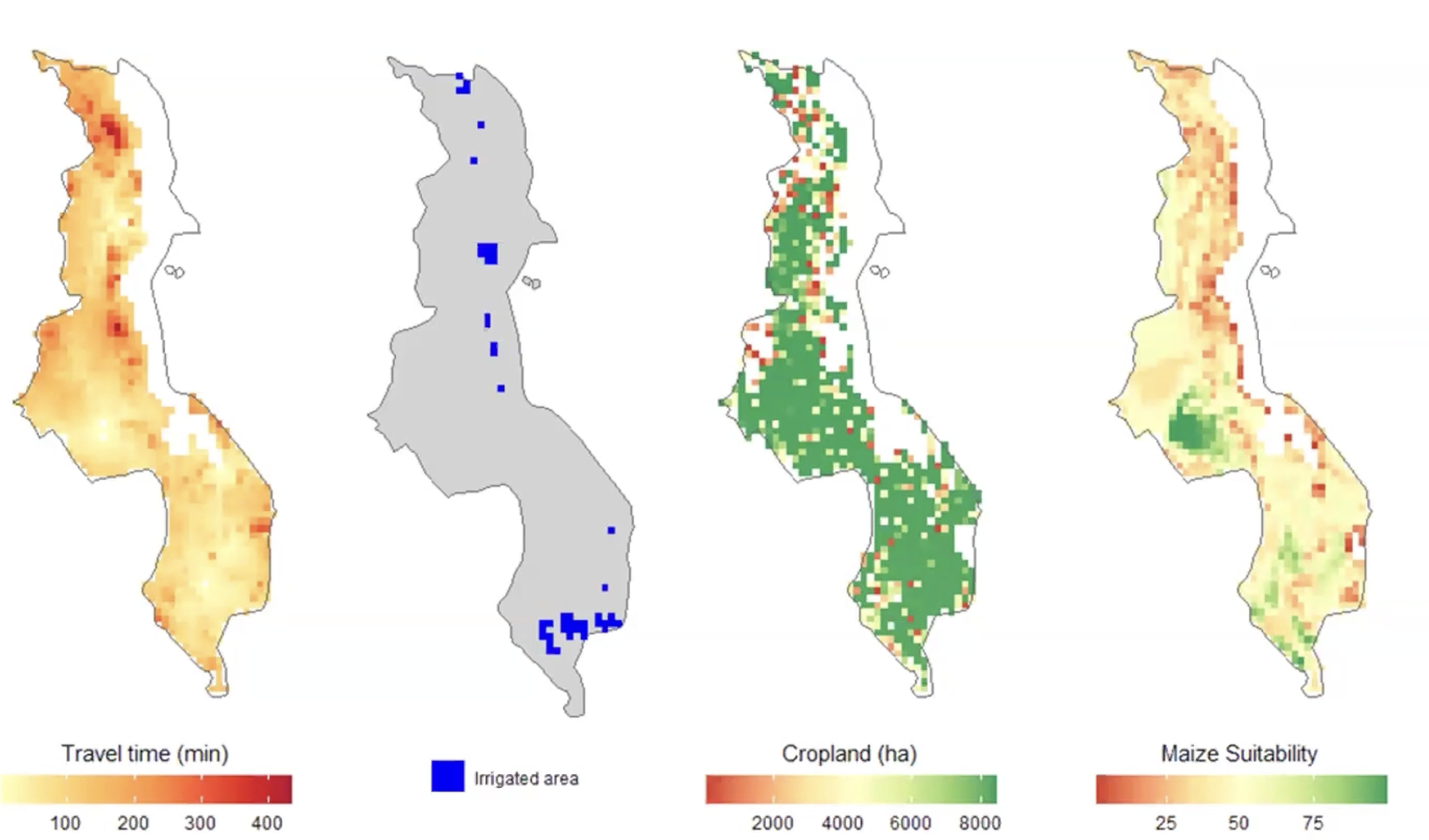
Zhe Guo